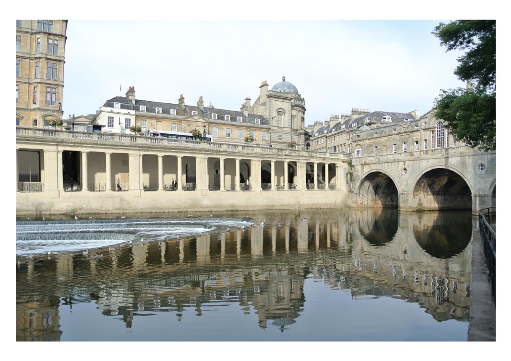
Planning permission has been granted to redevelop Bath’s hidden undercrofts and 18th century vaults beside Pulteney Bridge as a restaurant and possible museum.
The proposal for the long-unused area, drawn up by Bath architects Nash Partnership, is the first phase in Bath & North East Somerset Council’s (B&NES) ambitions to develop the social, cultural and economic significance of the historic Guildhall block which contains the council’s important civic facilities, archives, former law courts and the Victoria Art Gallery, alongside governance offices and a work hub.
Another of the council’s ambitions in granting planning permission and Listed Building Consent to the scheme is to open up frontages onto the Avon.
The city has long suffered from developments that turned their back on the river, resulting in Bath missing out of the type of waterside schemes that have transformed areas such as Bristol Harbourside and Cardiff Bay.
The new scheme, which will bring around 9,000 sq ft of space onto the market, will play a key role in the regeneration of Bath’s riverside, which the Enterprise Area downstream at North and South Quays is adding to.
It will also give residents and tourists a chance to understand more of how the Roman and Medieval areas of Bath accessed the river before Robert Adam’s famous Pulteney Bridge, built in the mid-18th century, did away with the need for one of the city’s former ferry crossings – the Colonnades frontage having been one of Bath’s main landing points for river traffic.
The areas now to be opened up all lie beneath Grand Parade – the public road between the river and the Guildhall block and former Empire Hotel.
They are currently wholly hidden from view behind a high screen wall and the colonnades built in the 1930s that now flank Pulteney Bridge.
The scheme will open up for pedestrian use two paths, known originally as Boat Stall Lane and Slippery Lane and now below present street level, the Boat Stall, with the Roman and Medieval city, subject to agreement with an adjoining landowner in Slippery Lane.
One of the few remnants of the pre-18th century city wall is visible at Boat Stall Lane, where the arch and gate hinges of the old East Gate are still open to view.
Nash Partnership handled the architectural, heritage asset value and planning aspects of the applications.
Senior partner Edward Nash said: “After many decades of under appreciation, Bath’s extensive former industrialised urban riversides are being regenerated to bring new social, economic and environmental value to the city.
“But this regeneration is being planned to occur right at the heart of the World Heritage city, too. This scheme will bring more than 100m of the riverside overlooking Pulteney Weir back into regular pedestrian and commercial use for the first time since Bath’s Empire Hotel was taken over by the MoD in World War Two.
“It will bring new waterside restaurants, places to visit, new activity to Parade Gardens, and reopen the surviving ancient gate from the pre-Georgian walled city through which residents crossed the river before Robert Adam’s famous bridge was built.”
In such a sensitive area of the city, 25 options for accessing these areas had to be explored, visualised and tested through the pre-application process. A multitude of interests of other highway users, adjoining landowners’ needs and the operational demands of servicing, ventilation, flood risk, deliveries, waste and recycling all had to be handled with care in such a densely used part of the historic city centre.
Pictured: A CGI image of the development


